Chasing Peaks

Adventure - Experience - Expedition

Navigation Courses

Return to the overview

NNAS Silver (Intermediate)

Designed to provide you with the majority of navigational strategies, this course will see you walking off the beaten tracks and paths in no time. Building on your existing map reading knowledge we take a close look at the finer details while also introducing you to basic compass work and some more advanced strategies. Alongside technical navigation skills we will also be covering off some personal walking topics around planning, kit and conservation.

<
>

Upcoming open sessions:

None at this time

Any pre-requisites?

You should be able to navigate along paths and tracks. If you are a dog walker or regularly walk in unfamiliar areas you will be absolutely fine. If you struggle to find a sensible route in your own home town/city or have problems driving to places without a satnav we would recommend our NNAS Bronze course first.

What will you learn?

  • Identifying and using ever smaller landforms
  • Taking and using compass bearings
  • Detailed distances, timings and pacing
  • Coarse navigation, attack points and fine navigation
  • Detailed map symbols
  • Maintaining navigational accuracy in poor visibility
  • Error avoidance, recognition and relocation
  • Impact of fitness, fatigue and terrain on route choice in planning and on the ground
  • Impact of weather on the day

What can you expect?

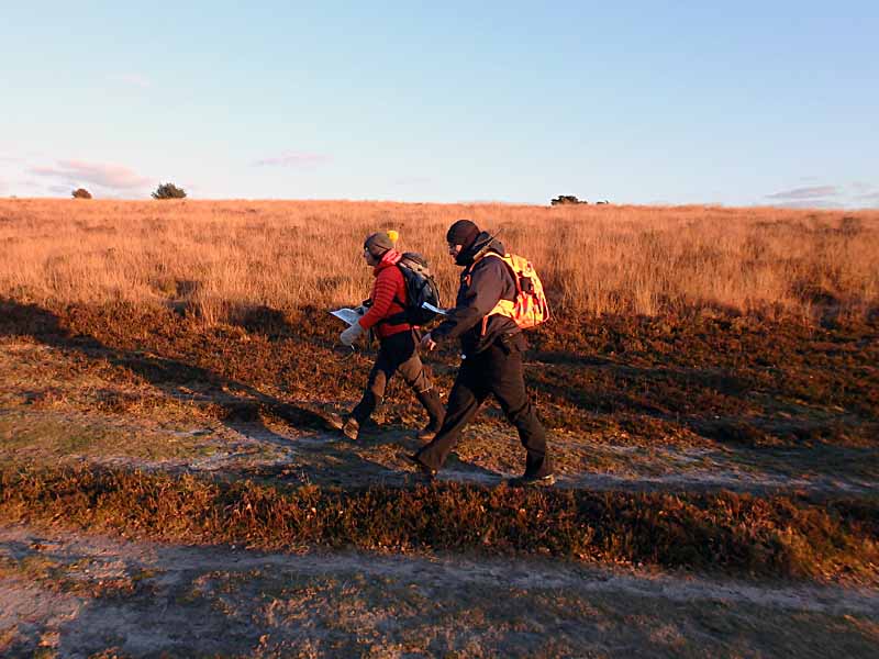
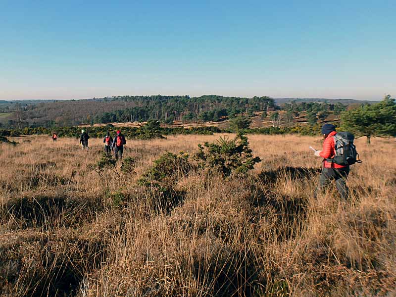
Learn to plan and execute a route in Britain's more remote countryside, away from defined tracks and paths.

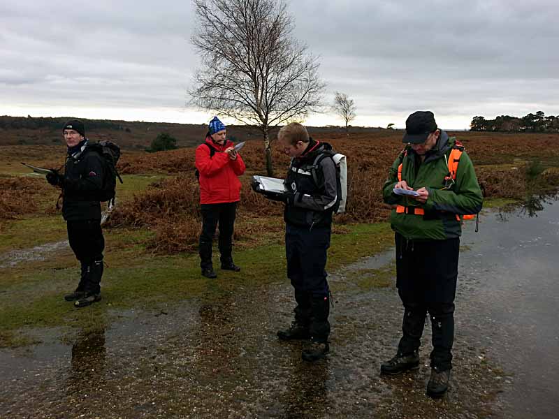
Depending on where the course runs we will either meet in a cafe or a walkers car park on day one. After some initial admin and getting to know the group we will soon be on our way. Chances are your trainer will initially want to find out what you already know and let you loose, independently navigating a small leg. Based on what they see they may choose to briefly recap some basics or dive straight into the syllabus. Most of the first morning will be taken up with emphasising the basics of map work while also introducing more advanced and subtle features into the mix.
Over lunch you will discuss the impact of weather, fatigue and fitness on a walk and also what is expected of countryside users and walkers.
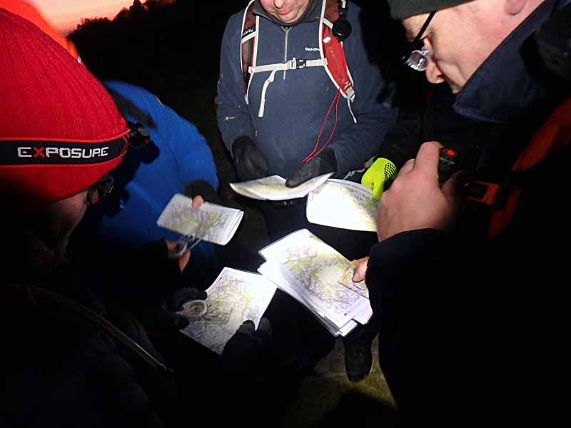
The afternoon will be spent getting to grips with the compass. Taking bearings in our experience is a bit like riding a bike; once you've "got it" it's hard to forget it again. When visibility deteriorates, your compass becomes your best friend away from paths and your trainer will show you how to use it effectively and systematically. Depending on the time of year we may round off the day with some navigation during dusk or early darkness.

Day two will start in a cafe where we will be carrying out a quick "assessed" route planning exercise. You will be given a map of an area you have not seen before and asked to find a suitable route between pre-marked waypoints. While we count this exercise into the assessment there is no pass or fail on the element, it is merely a vehicle to get you to discuss your route choice and map detail.
Once completed, we will head back out into the open countryside and consolidate the previous day with some warm up exercises. This is your chance to ask the last few questions you may still have and calm your nerves before your trainer starts the "formal" assessment.
Practically, there is little difference between the training and assessment as you will have navigated most of the time anyway. You will be asked to individually navigate to specific features while the rest of the group follows your strategy and tries to keep track. Compared to Bronze level the detail of the features will increase and at this level your trainer will expect a good level of accuracy and consistency across the entire assessment. Nevertheless, they will continuously assess the group as a whole and minor mistakes will not mean the end of your world.
At the end of the second day your trainer will give you your assessment result and any individual feedback, allowing you to ask any further questions you may have.

What do you need to bring?

Participants should be equipped for a normal day walk out with warm layers, waterproofs and sturdy boots.

All participants will require a 360° baseplate compass, ideally with a magnifying glass built in. There are cheaper and more expensive models on the market to choose from starting around £5 for a cheap Hi Gear compass to £30 for a Silva Expedition 4 model. Our instructors favour the Silva Expedition 4 (non-military model) although the Silva Ranger model is a viable alternative. Whichever compass you choose to bring along make sure it is a baseplate style like the ones mentioned here, has a rotating compass housing with 360° markings, a clearly marked needle (two colours) and comes with measuring scales along the side. Ideally one of these scales should be 1:25k/1:25000 and another should be 1:50k/1:50000. If you are in doubt about a particular model give us a shout and we'll tell you whether it's suitable.

We provide all mapping for the duration of the course and you will be able to keep the maps you have used for future use and reference at no extra cost.

Is the course accredited?

This course is accredited through the National Navigation Awards Scheme and as such includes an element of assessment. The assessment takes place during the second day and will involve candidates showing what they have learnt in practice. We aim to provide a relaxed and informal assessment atmosphere while maintaining the necessary standards. Let us know if you are anxious about this and we can discuss this further.

Return to the overview

×
What do our difficulty values mean?

Suitable for beginners with little or no previous knowledge and experience.
For walking activities you should be able to walk at a slow to average pace continuously for 30 minutes.

Suitable for intermediates with basic knowledge and previous experience.
Walking participants should be able to walk at an average pace continuously for 1 hour.
Climbing participants should be able to pass a belay test and/or demonstrate good bouldering practice.

Suitable for those competent at and comfortable with the basics of the activity.
Walking participants should be able to walk at an average pace and ascent rate continuously for 1 hour.
For mountain activities, you should be a little sure-footed and not hugely afraid of heights, as activities may include short sections of exposure and steep ground.
Climbing participants should be able to comfortably and competently top-rope grade 5 climbs or boulder the equivalent.

Suitable for experienced participants with above average fitness and knowledge.
Walking participants are expected to be able to walk at an average pace and rate of ascent continuously for 1 hour over broken terrain.
For mountain activities you are expected to be sure-footed, have a moderate head for heights and be happy with longer stretches of moderate exposure.
Climbing participants are expected to competently lead climb/belay and climb grade 5 indoors (or the equivalent boulder grade).

Suitable for very experienced participants with high degrees of fitness and above average knowledge of the basics.
Walking participants are expected to be able to walk to Naismith's rule (3-4km/hr + 1min/10m ascent) steadily for long periods of time over broken and complex terrain.
For mountain activities you are expected to have a good sense of balance, be sure-footed and happy with long stretches of, at times severe, exposure.
Participants are expected to show high levels of competence and self-sufficiency in their disciplines.

×
Our current private course price list:
For the prices listed here, we deliver a private booking just for you, on your chosen date and time. Where practical we will deliver the booking in your chosen location, though any areas outside of our usual operational areas may incur extra travel costs. We will let you know should this be the case. You will receive a full breakdown of costs with your quote.
Scrambling£180 for the first 2 participants, £45 for each additional participant

A significant portion of the day is spent scrambling in complex, rocky and steep terrain.

Mountain Walk£180 for the first 4 participants, £45 for each additional participant

Most of the day is spent walking in the mountains, though short sections of scrambling and steep terrain may be encountered.

Hill Walking£170 for the first 4 participants, £25 for each additional participant

Days involving no possibility of scrambling and encountering rocky or steep terrain.

Lowland Walking£160 for the first 6 participants, £20 for each additional participant
Beginner Navigation£390 for the first 4 participants, £75 for each additional participant

2 days learning the fundamentals of navigating with map and compass.

Intermediate Navigation£410 for the first 4 participants, £100 for each additional participant

2 days intermediate navigation, learning to navigate off path and across open countryside.

Advanced Navigation£360 for the first 2 participants, £120 for each additional participant

2 day advanced navigation course learning to navigate in mountaineous terrain and remote countryside.