Chasing Peaks

Adventure - Experience - Expedition

Navigation Courses

Return to the overview

NNAS Bronze (Beginner)

Using largely man-made features we will be taking you on a journey along Britain's many trodden paths. Our focus will remain firmly on the map and how it relates to our surroundings while steadily increasing the level of detail used. While we will touch on compass basics, we believe that the fundamental secret of effective navigation is to read your surroundings and relate them to your map.

<
>

Upcoming open sessions:

None at this time

Any pre-requisites?

Recent experience of walking in the countryside is a bonus, but no prior experience is required.

What will you learn?

  • Navigating using a variety of maps and scales
  • Use of grid references
  • Orientating a map using features and a compass
  • Use of linear features for navigation
  • Identifying prominent landforms (hills, valleys) on the map
  • Basic map symbols to confirm your location
  • Distances on the map and the ground
  • Plan and implement simple routes
  • Recognising navigation errors and correcting them
  • Where you can walk in the UK
  • What you should take with you when on a walk
  • What to do when things go wrong

What can you expect?

Learn to plan a route and navigate confidently and competently along Britain's paths, tracks and bridleways.

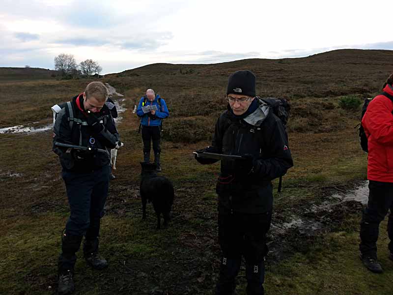
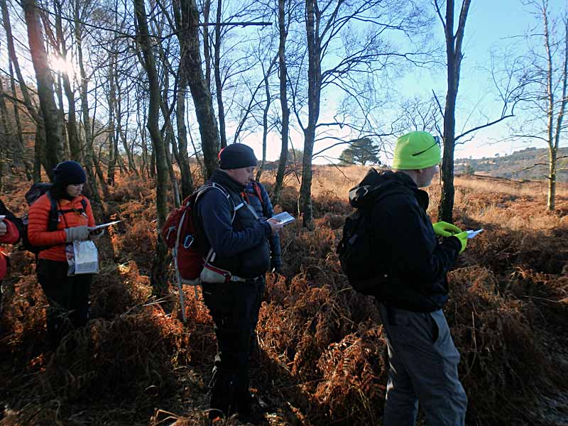
Depending on where the course runs we will either meet in a cafe or a walkers car park on day one. After some initial admin and getting to know the group we will soon be on our way navigating along the tracks and paths of the British countryside. Starting from the very beginning we will introduce you to the basic concepts of map orientation, linear features, map symbology and timings.
During the lunch break we will discuss walking kit, the countryside code and some basic route planning strategies.
The afternoon continues along the same lines as the morning, though we will steadily increase the amount of information you absorb. All the while you will practise every new technique, tactic and strategy yourself to find out what works well for you and what doesn't. By the end of day one we will have covered the vast majority if not all of the syllabus and will be looking forward to day two.

Day two will start in a cafe where we will be carrying out a quick "assessed" route planning exercise. You will be given a map of an area you have not seen before and asked to find a suitable route between pre-marked waypoints. While we count this exercise into the assessment there is no pass or fail on the element, it is merely a vehicle to get you to discuss your route choice and map detail.
Once the table based assessment is done we will head out onto the tracks and paths again to cover off any leftovers from the previous day or to answer and demonstrate any questions you may have. When the group feels happy with what they know or we have hit lunch time we will usually start the "formal" assessment.
Practically speaking there is little difference between the training and the assessment, as you will have navigated yourself for most of the course. Albeit now, your trainer will take a step back and observe how you use the strategies you were taught. You will have plenty of opportunities to make mistakes and correct them, as all members of the group are assessed continuously and as such you passing the course does not rest on one golden moment.
At the end of the second day your trainer will give you your assessment result and any individual feedback, allowing you to ask any further questions you may have.

What do you need to bring?

Participants should be equipped for a normal day walk out with warm layers, waterproofs and trainers/hiking boots.

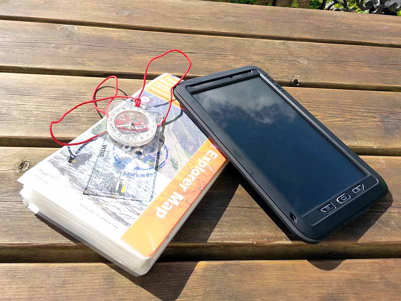
All participants will require a 360° baseplate compass, ideally with a magnifying glass built in. There are cheaper and more expensive models on the market to choose from starting around £5 for a cheap Hi Gear compass to £30 for a Silva Expedition 4 model. Our instructors favour the Silva Expedition 4 (non-military model) although the Silva Ranger model is a viable alternative. Whichever compass you choose to bring along make sure it is a baseplate style like the ones mentioned here, has a rotating compass housing with 360° markings, a clearly marked needle (two colours) and comes with measuring scales along the side. Ideally one of these scales should be 1:25k/1:25000 and another should be 1:50k/1:50000. If you are in doubt about a particular model give us a shout and we'll tell you whether it's suitable.

We provide all mapping for the duration of the course and you will be able to keep the maps you have used for future use and reference at no extra cost.

Is the course accredited?

This course is accredited through the National Navigation Awards Scheme and as such includes an element of assessment. The assessment takes place during the second day and will involve candidates showing what they have learnt in practice. We aim to provide a relaxed and informal assessment atmosphere while maintaining the necessary standards. Let us know if you are anxious about this and we can discuss this further.

Return to the overview

×
What do our difficulty values mean?

Suitable for beginners with little or no previous knowledge and experience.
For walking activities you should be able to walk at a slow to average pace continuously for 30 minutes.

Suitable for intermediates with basic knowledge and previous experience.
Walking participants should be able to walk at an average pace continuously for 1 hour.
Climbing participants should be able to pass a belay test and/or demonstrate good bouldering practice.

Suitable for those competent at and comfortable with the basics of the activity.
Walking participants should be able to walk at an average pace and ascent rate continuously for 1 hour.
For mountain activities, you should be a little sure-footed and not hugely afraid of heights, as activities may include short sections of exposure and steep ground.
Climbing participants should be able to comfortably and competently top-rope grade 5 climbs or boulder the equivalent.

Suitable for experienced participants with above average fitness and knowledge.
Walking participants are expected to be able to walk at an average pace and rate of ascent continuously for 1 hour over broken terrain.
For mountain activities you are expected to be sure-footed, have a moderate head for heights and be happy with longer stretches of moderate exposure.
Climbing participants are expected to competently lead climb/belay and climb grade 5 indoors (or the equivalent boulder grade).

Suitable for very experienced participants with high degrees of fitness and above average knowledge of the basics.
Walking participants are expected to be able to walk to Naismith's rule (3-4km/hr + 1min/10m ascent) steadily for long periods of time over broken and complex terrain.
For mountain activities you are expected to have a good sense of balance, be sure-footed and happy with long stretches of, at times severe, exposure.
Participants are expected to show high levels of competence and self-sufficiency in their disciplines.

×
Our current private course price list:
For the prices listed here, we deliver a private booking just for you, on your chosen date and time. Where practical we will deliver the booking in your chosen location, though any areas outside of our usual operational areas may incur extra travel costs. We will let you know should this be the case. You will receive a full breakdown of costs with your quote.
Scrambling£180 for the first 2 participants, £45 for each additional participant

A significant portion of the day is spent scrambling in complex, rocky and steep terrain.

Mountain Walk£180 for the first 4 participants, £45 for each additional participant

Most of the day is spent walking in the mountains, though short sections of scrambling and steep terrain may be encountered.

Hill Walking£170 for the first 4 participants, £25 for each additional participant

Days involving no possibility of scrambling and encountering rocky or steep terrain.

Lowland Walking£160 for the first 6 participants, £20 for each additional participant
Beginner Navigation£390 for the first 4 participants, £75 for each additional participant

2 days learning the fundamentals of navigating with map and compass.

Intermediate Navigation£410 for the first 4 participants, £100 for each additional participant

2 days intermediate navigation, learning to navigate off path and across open countryside.

Advanced Navigation£360 for the first 2 participants, £120 for each additional participant

2 day advanced navigation course learning to navigate in mountaineous terrain and remote countryside.